Introduction: Arduino GPS Map Navigation System


Built on the basis of Arduino UNO, GPS, SD card,TFT, GPS map navigation system is to obtain the real-time position information via GPS, to send it to UNO for calculation, according to the calculating results, and teamed up with the map file stored in SD card, thus presenting the position on TFT. The GPS system, owing the function to store the current position information, can be applied to running positioning and to record the running tracing.
Step 1: Prepare
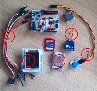
- Dupont Line
Freaduino UNO
SD card
Step 2: Make


(1) Connect TFT1.8 shield to UNO according the table below.
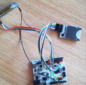
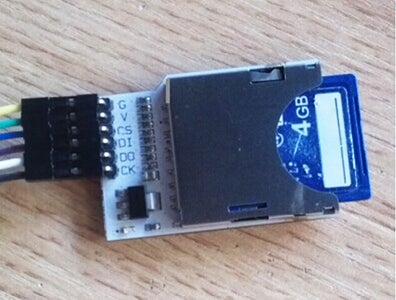
(2) Connect SD module to UNO according to the table below.
(3) Obtain the map file.
Release the file“maptile.exe” as follows:
Click the button in the red frame as the above picture shows, the interface shows as:
Select the option marked in red frame as above; left click to select
the map area needed to download; double click the left mouse button to finish.Left click the button in the red frame to finish downloading.
Copy the map file into the folder “SMARTGPS”within the SD card.
(4) Insert the SD card into the card slot of SD module.
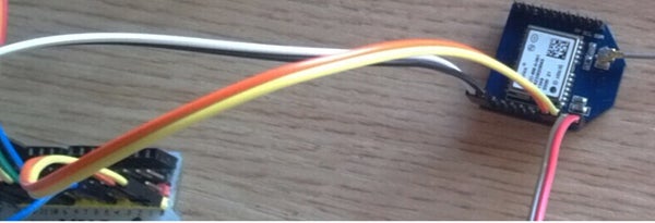
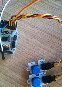
(5) Connect GPS Bee to UNO according to the table below.
(6) Plug the digital push buttons into D2, D3 separately on UNO.
(7) Download the codes into UNO. Do
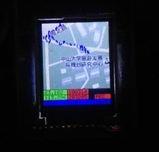
pay attention to disconnect the GPS from UNO because GPS takes up the interface of UNO. Power up after downloading, it operates as:
Source: ElecFreaks blog