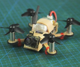
Introduction: DAS System for UAV Using Linkit One


Drones, UAV are mechanical systems but they are dependent on electronics telemetry systems for their positioning and geotagging in the real world
In this instructable, I'm gonna set a DAS system which provides Altitude, temperature and GPS coordinates of a UAV
Step 1: Altitude and Temperature

I have used MS5607 pressure and temperature sensor to get reading of altitude based on height and temperature of the surroundings
This chip is very delicate and sensitive to radiation, so do not expose it to direct sunlight. Once we get the height we can manipulate the data in the units we want
Step 2: GPS Coordinates

We use the inbuilt GNSS module of the string to get the coordinates of the UAV, we also get the velocity of the drone from GPS but that's not very dependable
Thus by using the Antenna provided with the board we can easily get the GPGGA string with all the data received from the satellites.
Step 3: Connections

MS5607
• Vin - 3V3
• Gnd - Gnd
• Scl - Scl
• SDA - SDA
GPS:
Connect the antenna to the GNSS port. Rest everything is integrated within the board
Wifi:
We are gonna send the data through WiFi, thus connect the WiFi antenna to the board
Note: The connectors of wifi and GPS are very sensitive, be careful while connecting
Step 4: Code
You will have to change the WiFi SSID and Password in the code.
In the code I take the readings from the altimeter, and concatenate with the string obtained from the GPS ie. GPGGA
the final string format looks like this: %Altitue$GPGGA.....
This string is then transmitted locally over wifi and can be viewed on the browser as in the output.

Step 5: Compile and Output


The final output is seen on the local browser by entering the ip addresss of the board which is to me obtained from the serial monitor right after uploading.
Copy paste the IP address in the browser and see the magic of the board
The time required for the page to refresh can be controlled in the code.
Step 6: Further Processing

You can develop a GUI to showcase the data easily anticipated by the user like Speedometers, graphs, plotted location coordinates on a map