Introduction: Finding Direction, Distance and Navigating to a Distant Base by Stars, P.2: Fine Reading of Latitude.
by tonytran2015 (Melbourne, Australia).
.This is applicable to navigation in ocean or in large desert with clear, flat horizontal skyline. It uses the complementary stars touching the horizon instead of stars traveling directly over the zenith of the navigator. It is more suitable for sea travel with readily available horizon but unsteady travel platform. It is a useful trick to return to a base (e.g. a Polynesian island) when having no measuring instrument.
Step 1: Basis of the Method
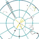
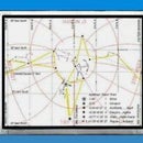
Figure: The trajectory of the complementary star touches or nearly touches the horizon. Figures: Horizon for an example latitude of 30degrees North projected onto North and South Celestial hemispheres respectively.
Stars travel along constant declination circles drawn on the Celestial sphere. If the base city is at latitude L then the constant declination circle of 90°-L on its same (North or South) hemisphere will be seen touching the horizon and the lowest position of the complementary star will be right on the horizon and in the principal Northern/Southern direction. When the (complementary) stars of declination 90°-L is at its lowest point near the horizon, unaided human eyes can easily tell its elevation accurate to 1/4 Moon's diameter (1/8 of a degree).
If bright complementary stars are unavailable for any latitude, users of this method have to identify some constellations having dim complementary stars for that latitude and use these stars instead.
Step 2: Preparation at Base for This Method.
Figures:: 20 brightest stars and their positions in the sky. Dimmer stars beyond this list may have to be used by this method for traveling to any arbitrarily given latitude.
1. Work out the latitude of the chosen city.
2. Work out the complementary angle for that latitude.
3. Use a list of bright stars (in reverse order of brightness) to choose a star or stars having declinations being equal or greater than the complementary angle by less than 2 degrees (the difference is less than 2degrees or 4 Moon's diameters). The less bright stars may have their declinations closer to required values but their poor visibility may make them unsuitable. The chosen star may slightly dive under the horizon but its neighbouring stars can indicate how far it has dived.
4. Practice identifying the complementary stars in all imaginable conditions.
Step 3: Field Application
5. Travel North or South until the lowest position of the complementary star touching or slightly above the horizon by less than 4 diameters of the Moon.
6. On attaining that latitude, only travel along a parallel circle to maintain the latitude.
Step 4: Examples.
Figure: The trajectory of the complementary star for London touches or nearly touches the horizon when viewed at the latitude of London..
London is at (0°5' longitude, 51°32' latitude), choose Vega (18hr 37 RA, +38.8deg declination). Around midnight of Dec. 25th, the star Vega travels to its lowest point on a circle glancing the horizon. Its distance from horizon is 51°32 + 38.8° - 90° = 0.3°.
This angle is half the diameter of the Moon and can be judged accurately by unaided eyes.
Berlin is at (13°25' longitude, 52°30 latitude), choose Vega (18hr 37 RA, +38.8deg declination). Around midnight of Dec. 25th, the star Vega travels to its lowest point on a circle glancing the horizon. Its distance from horizon is 52°32 + 38.8° - 90° = 1.3°.
This angle is 3 diameters of the Moon and can be judged accurately by unaided eyes.
Manila (120°57' longitude, 14°35' latitude), choose a dim star Beta Ursae Minoris, (Kochab, 14hr51RA, +74.3deg declination). Around midnight of Nov. 07th, the star Kochab travels to its lowest point on a circle glancing the horizon. Its distance from horizon is 14°35 + 74.21° - 90° = -1.3° (under the horizon by 1.3degrees. This angle is 3 diameters of the Moon and cannot be seen but its visible neighbouring stars in the Ursa Minoris group can indicate how far this star is below the horizon.).
Mecca(39°45 longitude, 21°29 latitude) choose Gamma Ursae Minoris (Pherkad Major, 15hr 21RA, +71.8° declination). Around midnight of Nov. 16th, the star Kochab travels to its lowest point on a circle glancing the horizon. Its distance from horizon is 21°29 + 71.8° - 90° = +3.3°. This angle is 7 diameters of the Moon and can be judged accurately by unaided eyes using fingerwidths on a stretched arm.
Tonga Capital city is Nukuʻalofa (175°12′W = 184°48' longitude, 21°08′S latitude). Choose the star Beta Carinae (Miaplacidus 09hr 13 RA -69.7decl). Navigators may have to identify the constellation Carina containing the bright star Canopus in order to identify a not quite bright Beta Carinae. Around midnight of Aug. 10th, the star Beta Carinae travels to its lowest point on a circle glancing the horizon. Its distance from horizon is 21°08' + 69.7° - 90° = +0.8°. This angle is 1 and 1/2 diameters of the Moon and can be judged accurately by unaided eyes.
Step 5: Notes on Terminal Homing of Journeys.
Near to the end of his journey, an ocean navigator may release island spotting birds.
If the birds can attain a height of 800m, they can spot land (even without using cloud features) at distance of 110km away (60 nautical miles, or 1 degree of arc or 2 Moon's diameters).
If the birds can attain a height of 250m, they can spot land (even without using cloud features) at distance of 55km away (30 nautical miles, or 0.5 degree of arc or 1 Moon's diameter).
If the birds can attain a height of 62m, they can spot land (even without using cloud features) at distance of 28km away (15 nautical miles, or 0.25 degree of arc or 0.5 Moon's diameter).
The navigator can also use currents, winds and even smells in this phase.
The error of this navigation method is thus well within the operational range provided by the spotting birds.
Reference
[1]. tonytran2015, Finding direction, distance and navigating to a distant base by stars, Instructables ,https://www.instructables.com/id/Finding-direction-... , posted on Nov 8, 2015.


