Introduction: Finding North Direction and Time From the Sun Using Bare Hands.
by tonytran2015 (Melbourne, Australia)
Even if his watch stops working at some unfortunate time, a well prepared person can still use the shadow stick method to work out both North direction and the approximate time to save the situation. Here I offer an even better method, it gives North direction accurately and gives rough time with +/- 30 minutes accuracy while the user is not required to stay still like in the shadow stick method. My method uses latitude, position of the Sun and the day in the year to instantanously gives out North direction and local time.
The divider used in the instructions is only for instructional purpose. Litterally, the method can be practiced with only bare hands.
Caution: This method requires accurate application of each step. Those who have not successfully obtained accurate results with “Finding North with a watch more accurately” should not practice this one.
Step 1: Estimate the Current Declination.
The whole Celestial spherical shell rotates around its two Celestial poles. The Sun moves slowly on that sphere on a great circle called the ecliptic. Its distance to the two opposite Celestial poles varies periodically, and its distance to the Celestial equator is call the declination of the Sun.
Make a rough sketch of this declination from the principal values and estimate the declination for the current day.
Step 2: Set the Divider to the Required Angle
The distance from the Sun to the South/North Celestial poles is 90degree +/- declination of the Sun. Set the divider to the angle from the Sun to the lower Celestial pole underneath the horizon.
Step 3: Point Leg CB of the Divider Exactly Into the Sun
Point the leg CB of the divider into the Sun.
Step 4: Work Out Which Side of CB to Place CA.
Work out CA points to the right or to left of CB.
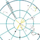
The compass rose in the figure helps working out the direction for turning the path. For example, if the method is used in the morning at a Northern latitude, the path along Sunrays comes from the East and has to turn left to go to the Southern Celestial pole (since this Southern Celestial pole is the lower Celestial pole at a Northern latitude), The path is shown in green colour in the compass rose.
As any wrong decision here may bring disaster to the user, newcomers to this method should practice with the Sun on low elevation angle and check their results against those from other familiar methods.
Step 5: Let CA Descend Into the Ground at Latitude Angle to Have Direction of Celestial Axis.
Rotate the whole divider about its leg CB until ACz' is equal to 90 degree – latitude angle to have the direction of the Celestial axis.
At that moment CA is pointing exactly along the Celestial axis. Hold the divider precisely in that orientation. North direction is only the ground projection of the Celestial axis.
Step 6: Look Along the Celestial Axis to Read the Local Time.
Look onto the point on the ground where CA is pointing to and keep CA pointing to it. CA is now aligned to the Celestial axis.
While looking down to the Southern Celestial pole from the Northern hemisphere, an observer can imagine having a 24hr clock dial attached to that axis and having it as the axis of the dial . The midday marking of this clock-face has the highest position on the dial.
Step 7: The Dial of Celestial Clock for Northern Latitudes.
The midday marking of this Celestial clock-face is the highest one on the dial. CB will move like the hour hand of this Celestial clock to give the local time. Local time is close to but is not the official zonal time, it displays 12 o'clock when the Sun is highest in the sky.
The dial for the Celestial Watch for Southern latitudes is anti-clockwise and is a mirror (left-to-right) reflection of this dial.
Step 8: Optional Extension of This Method
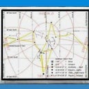
Figure 1: Summary of steps in this method.
If the Moon can be seen in day light, a navigator should continue from the so obtained direction of the Celestial axis to measure the declination of the Moon, its angular distance from the Sun and its relative lateness for that day. He can then continue his accurate determination of Celestial axis during the Moon lit part of the coming night by replacing the unseen Sun by the Moon together with its value of declination and angular distance from the Sun supplied a few hours earlier by himself.
The directional accuracy of this method reduces slightly when the Sun reaches its highest elevation. The navigator can overcome this problem by selecting in the earlier part of the day a visible distant object as a temporary directional marker for use in the duration when the Sun has its highest elevation. The navigator may also overcome this problem by supplementing this method with the use of a graph of Solar paths and accurate local time.


